
SeaSketch for the Santa Barbara Channel
/By Grace Goldberg
Right in our own backyard, the McClintock Lab has found a critical need for thoughtful marine spatial planning. The Santa Barbara Channel is home to diverse marine life, including protected species of whales, as well as a variety of human uses. For the past year the SeaSketch team has been immersed in supporting a special working group, convened by the Channel Islands National Marine Sanctuary (CINMS) focused on effective management, research and outreach surrounding one of these key human uses: marine shipping.

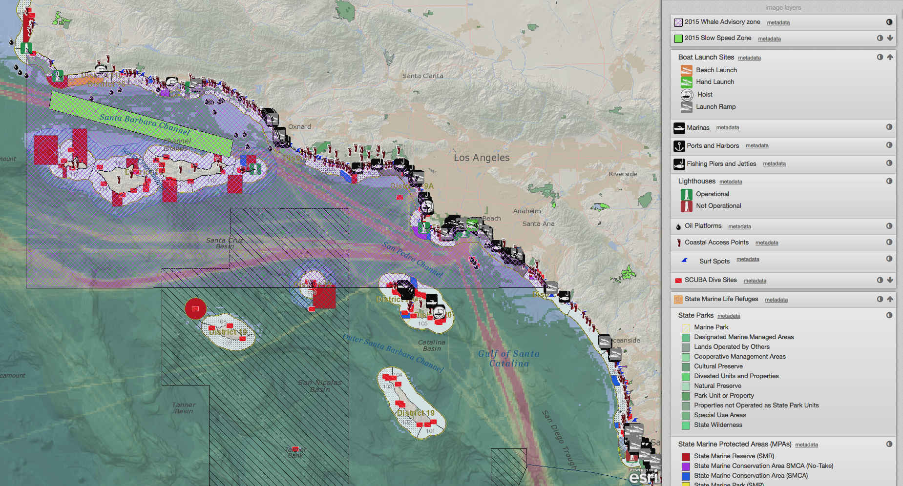
Data visualization at safepassage.seasketch.org, demonstrating the need for MSP.
Over four in-person meetings, the Marine Shipping Working Group (MSWG) considered the best available science and information and collaboratively developed solutions with four key goals: (1) reduce ship strikes on whales, (2) improve air quality, (3) improve navigational safety and maintain efficiency for maritime traffic, and (4) minimize conflicts between multiple ocean users including disruption of Naval activities in the area. This type of work requires that participants have a central location to access the key information, mechanisms for both remote and in person collaboration, and a way to share their spatial and non-spatial ideas. You can learn more about the Marine Shipping Working Group, and even read their final report of recommendations and findings online (here). We configured their SeaSketch project with:
Map Viewer & Data Layers: We began filling the safepassage.seasketch.org project with readily available public map services, hosted by NOAA and the CA Dept. of Fish and Wildlife. CINMS staff put together data layers to display management measures previously implemented in the area. Kicking off the first working group meeting, and continuing for months of remote collaboration, stakeholders and domain experts identified additional key datasets to be added to the project. The working group also determined details about how the data were presented in the project, including the minimum metadata required, appropriate symbology, and extra descriptions associated with controversial datasets.
Sketching Tools: Over the course of the process, the available sketch classes adapted to meet the needs of participants. In the end, the SeaSketch project could be used to sketch out not only shipping lanes, but multiple specific routing measures with geoprocessing scripts that transform a sketched out path into a two-way traffic scheme. When sketching out a potential Management Area, users are able to choose from a suite of possible zone types. As soon as a user clicks ‘Save’, they can analyze those plan ideas for overlap with existing infrastructure, overlap with multiple whale distribution data sets, and the potential impact to air quality related emissions.
Collaboration Tools: Forums provided a space for remote collaboration, from discussions about appropriate use of available data to feedback and deliberation on proposed management recommendations. The forums allow participants to link their posts to relevant data layers, and share spatial plans or longer external documents. In addition to keeping the conversation going remotely between meetings, the forums were also used to record meeting minutes, capturing how ideas on the map evolved through in-person meetings.
For information on putting together a SeaSketch site for your project, please contact Grace Goldberg (grace.goldberg@ucsb.edu).