Finding Common Ground

Finding Common Ground

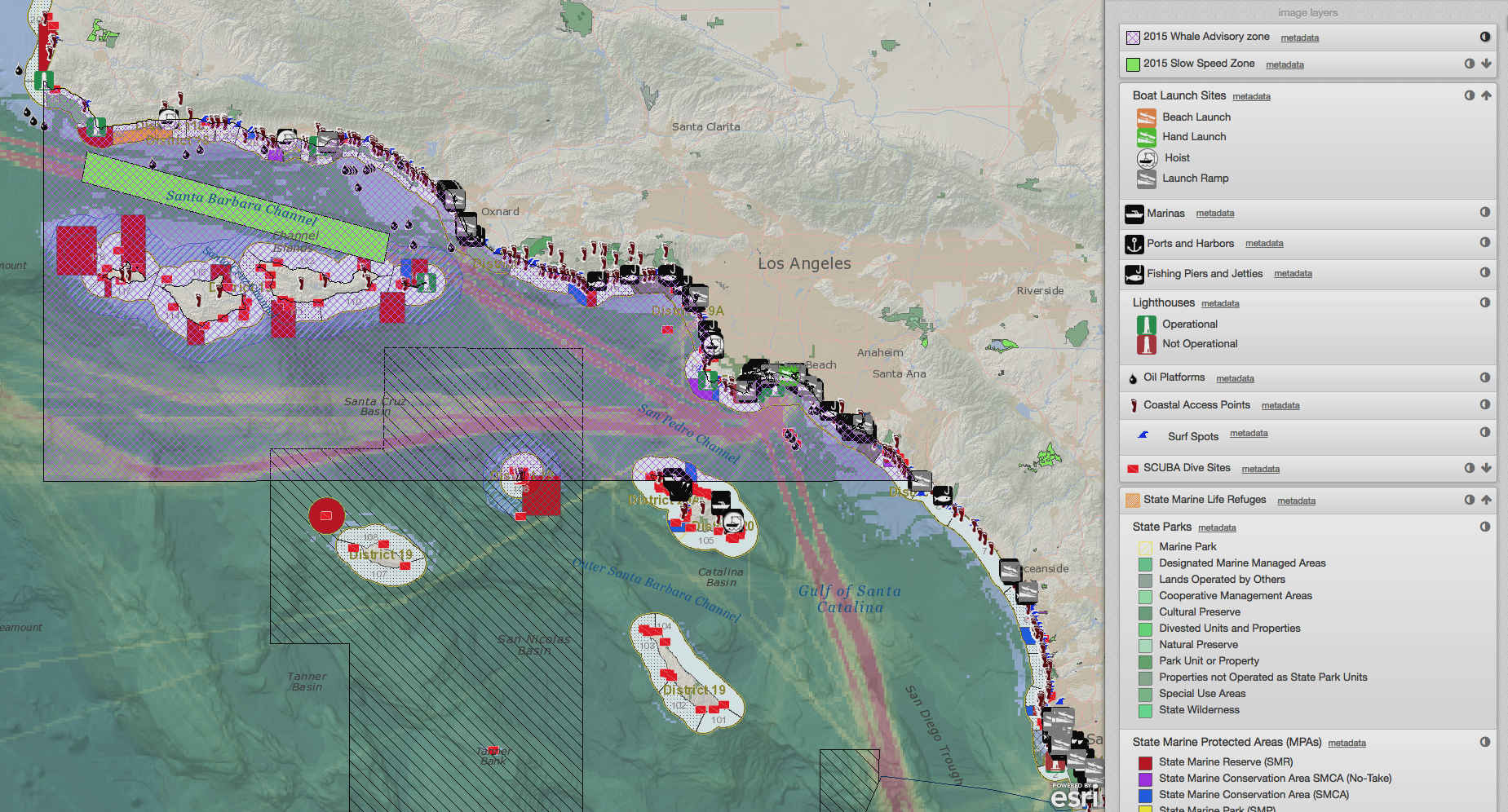
When creating plans, for the ocean or otherwise, it's often helpful to know if others are planning something for the same place. Knowing what others are planning can help reduce conflict and maximize the sustainable use of resources. With a recent SeaSketch update, this kind of work just got easier. Read about the project and SeaSketch features below. 

Read More

Using Two Tools: Linking SeaSketch with the InVEST habitat risk assessment in the Galapagos archipelago

Using Two Tools: Linking SeaSketch with the InVEST habitat risk assessment in the Galapagos archipelago

2016 is turning out to be a big year for marine sanctuaries. Currently only about 3 percent of the world’s oceans are protected. President Obama just nudged the percentage up a little with the recent decision to expand the Papahānaumokuākea marine sanctuary in Hawai’i.  But earlier this year, Ecuador had its own historic moment, when the president announced a new marine sanctuary around the Galapagos islands.

Read More

Toward Measuring Tool Impact: What can environmental planners learn from log and usage analysis?

 Toward Measuring Tool Impact: What can environmental planners learn from log and usage analysis?

Analyzing user behavior with computer science methods is common in commercial website design, where a subfield called web analytics uses electronically gathered quantitative data to gain insights about user behavior. Commercial companies use this information for a variety of purposes, from improving search engine performance and customizing a user’s experience to targeting ads in ways that may seem unnerving. What can be done with the information depends on two key factors: (1) what and how information is collected (2) laws, polices, and norms governing the use of information.

Read More

The Impacts of Using a GeoSpatial Tool: Results from evaluations of SeaSketch’s predecessor published

 The Impacts of Using a GeoSpatial Tool: Results from evaluations of SeaSketch’s predecessor published

Why should we invest in geospatial tools? What makes them so valuable in science-based participatory process? In light of exciting progress toward the U.S. National Ocean Policy and marine spatial planning goals globally, and the proliferation of mapping portals and tools to support this work, we share this critical examination of MarineMap, the award-winning mapping platform that supported California's Marine Life Protection Act Initiative. From 2012 to 2014, the McClintock lab collaborated with Amanda Cravens, to investigate MarineMap, the predecessor to SeaSketch. Apaper describing part of the results of that research was recently published, and we have boiled down the key lessons learned in this post.

Read More

Mapping with Stakeholders in Curaçao

Mapping with Stakeholders in Curaçao

A seemingly improbable blend of Dutch, Spanish, and Portuguese influences, Curaçao, formerly part of the Netherlands Antilles, is as colorful on land as the marine life found just off its shores. Home to white sand beaches, colorful Dutch architecture, and the oldest synagogue in the western hemisphere, it’s of little surprise that this Caribbean island attracts large numbers of tourists. Numerous dive shops provide tourists the chance to view resplendent coral communities and marine wildlife. Curaçao’s rich coastline also supports a contingent of fishermen that catch marine fish for themselves and to sell to the community and local restaurants.

Read More